


Challenge: 12 disorganized routes, high operating costs, inconsistent delivery times.
Solution: Implementation of territory optimization algorithms with multivariable analysis and zone restructuring.
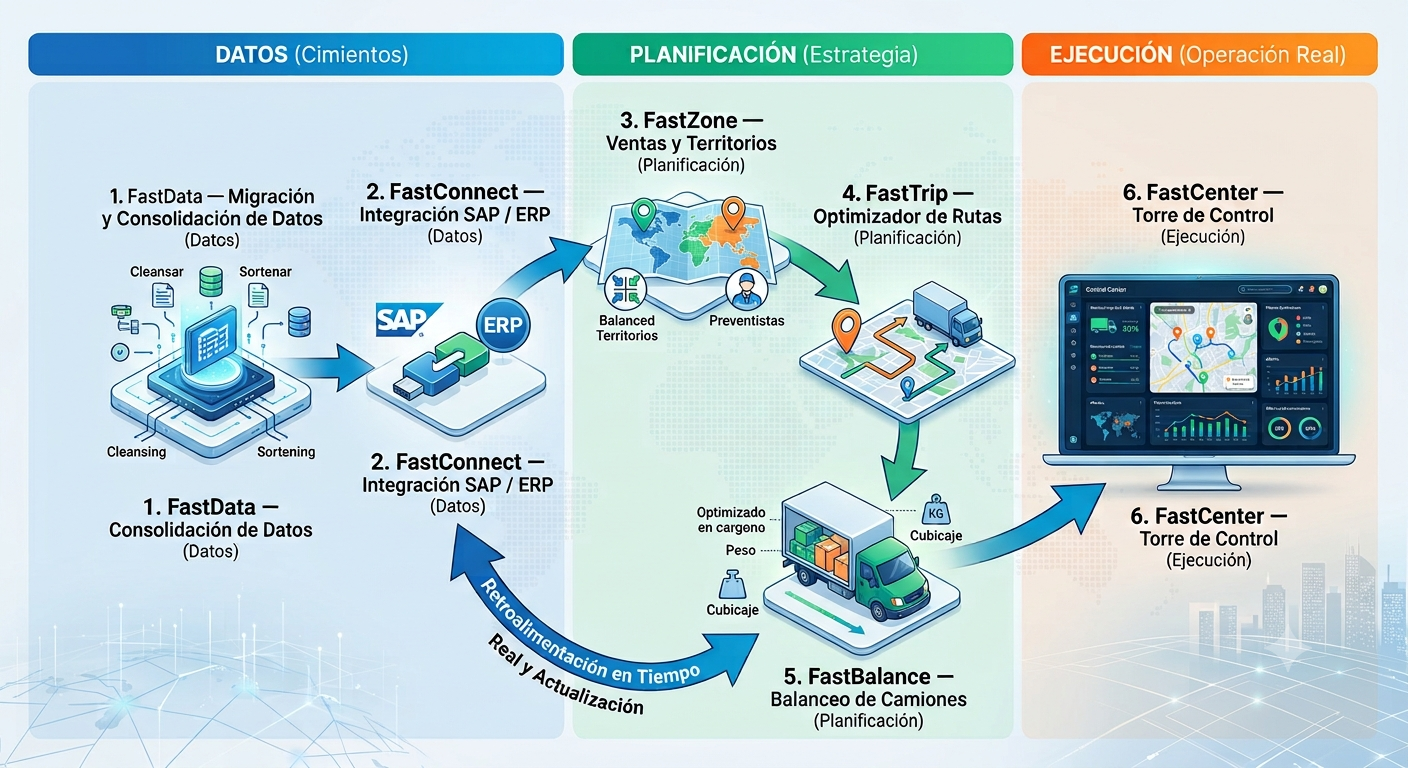
We connect your sales, optimize your load and control your fleet in real time with integrated logistics software.
Two pillars: the brain — consulting and data management — and the muscle — a suite of specialized applications integrated with your ERP.
We migrate and unify the databases of your whole operation onto a single server, with ETL models (jobs and stored procedures) ready to analyze thousands of routes.
Desktop programs that connect any version of SAP, or any ERP, to your route optimization tools without rebuilding your systems.
Balance your pre-sales reps' workload and set different visit frequencies based on the variables that matter to your business.
Route optimization 100% in the cloud, with nothing to install. It calculates the best routes and cuts distance, time and cost.
Balance the load by cubing and create any kind of product rule. Get the most out of every truck and cut the number of trips.
A central application to oversee your whole operation in real time. And if you need something specific, we build it to fit your business.
Custom dashboards on Power BI technology, with export to Excel or PDF. A deep view of your operation without leaning entirely on your IT team.
We will show you any of our products running, in a demo built around your operation.
We migrate, consolidate and clean your data and leave it reliable and ready for the whole suite. No optimization is better than the data feeding it.
Before you zone territories, calculate routes or build dashboards, your data has to be complete, unique and correctly located. FastData takes your scattered information — in Excel, legacy systems and your ERP — and builds solid ground: a single master of customers and products, clean and geocoded, on which the whole ecosystem works.
Bring your data from spreadsheets, legacy systems and your ERP (SAP) and unify it into a single master of customers and products.
It removes duplicates, normalizes formats and validates the information, with reports that show the true state of your data.
It places your customers on the map from their addresses — essential so FastZone and FastTrip work over real points.
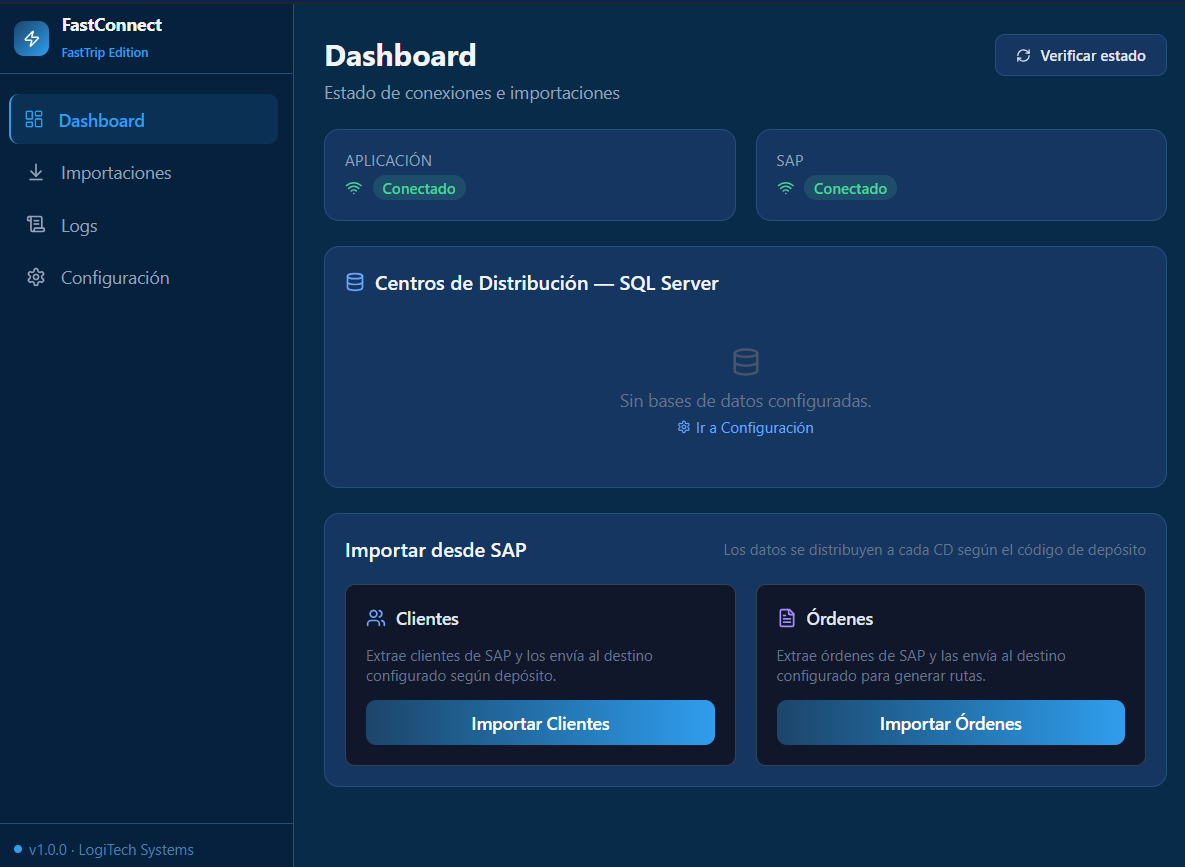
The smart bridge between your ERP (SAP) and FastTrip. It removes manual data entry, cuts errors and automates your daily logistics operation. Available as a desktop application (Windows) and as a web application from any browser.
The data moves on its own: from the ERP to FastTrip and the optimized routes back to the ERP — with no manual typing.
Companies running SAP alongside distribution systems and route optimizers repeat the same manual work every day: export customers and orders from SAP, upload them to another system one by one or through Excel, then deal with typing errors and stale data. FastConnect automates that whole process end to end.
SAP import · preview (Preview → Commit) before confirming, with a history and statistics for every load
Visual workflows · turn each service on or off with one click and send to several destinations at once
It connects straight to SAP and extracts customers and sales orders in seconds.
The data extracted from SAP is sent to one or several destinations at the same time.
It reads the planned routes and automatically exports them back to the ERP.
It carries locations and planned routes to the field execution platform.
For companies with several distribution centers, each with its own database.
Adapt FastConnect to your operation without touching a line of code.
| Edition | For whom | Includes |
|---|---|---|
| FastTrip | FastRoute internal use | SAP → FastTrip |
| Distribution | Distribution customers | SAP → SQL Server + Routes + Mobile tracking + Optimizer |
| Full | Administrators / developers | Everything enabled |
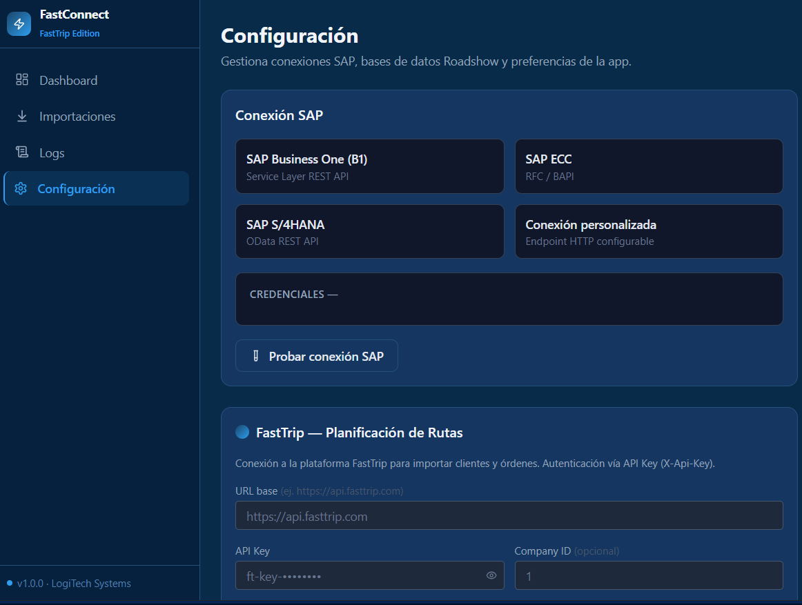
| Version | Connection method |
|---|---|
| SAP Business One (B1) | Service Layer REST API |
| SAP ECC | RFC / BAPI |
| SAP S/4HANA | OData REST API |
| Any ERP / custom system | Configurable HTTP endpoint |
Your SAP data never leaves your infrastructure.
It adapts to the infrastructure you already have, with no database of its own.
Measurable results from day one.
Zone customers, set visit frequencies and optimize your sales team's routes, all driven by data.
FastZone turns your customer master into balanced territories and a clear visit plan. It groups your customers by workload, sets how often to visit them and calculates the best route sequence based on how your rep travels — by car, motorcycle or on foot — with the real time between each visit.
It groups your customers into territories balanced by workload: number of customers, weight, volume and sales amount.
Set how often to visit each customer with business rules: customer type, allowed days and frequencies by zone.
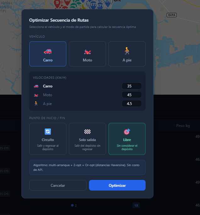
It calculates the best visit sequence based on the mode of transport — car, motorcycle or on foot — with the real time between each stop.
There is no single way to build territories. FastZone balances the workload with whichever algorithm fits your operation best.
It minimizes each zone's internal spread to produce homogeneous territories that are easy to cover.
It divides the area into angular sectors from a central point, like slices of a pie from the depot.
It generates territories in rings around a central point, scaling outward in an orderly way.
It groups stops by geographic proximity. Ideal for compacting dense areas and cutting travel.
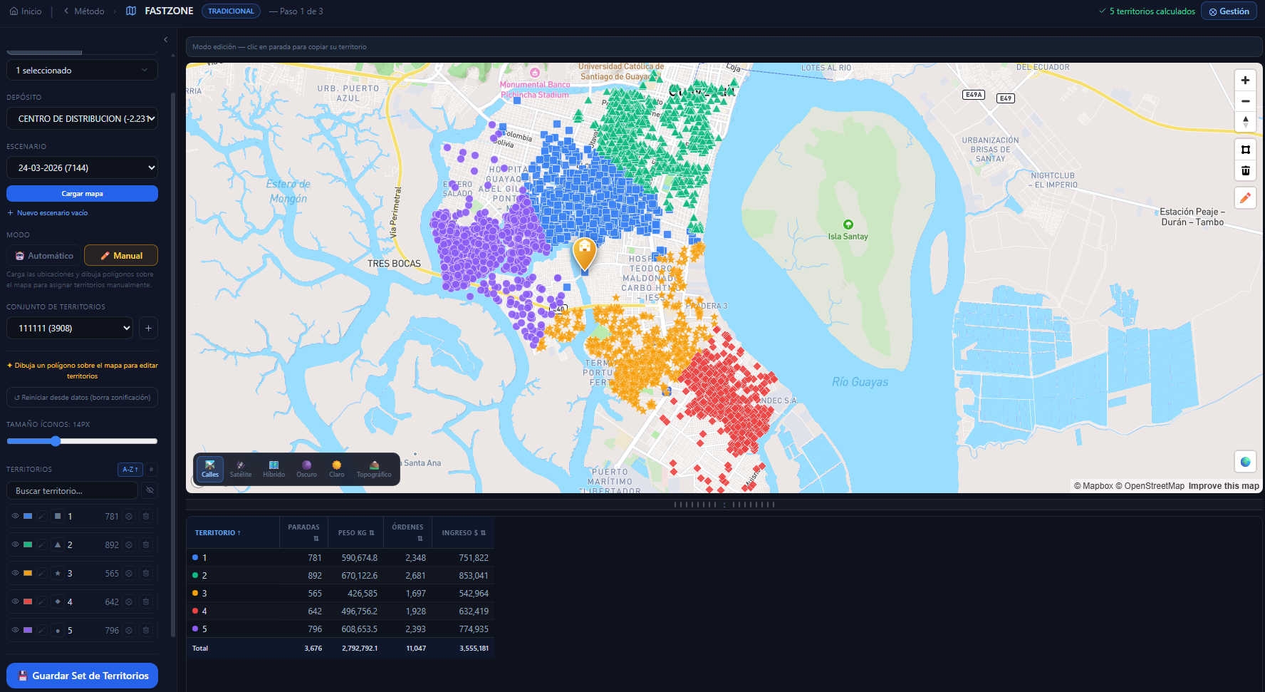
Main view · Territories on a real map plus KPIs by zone
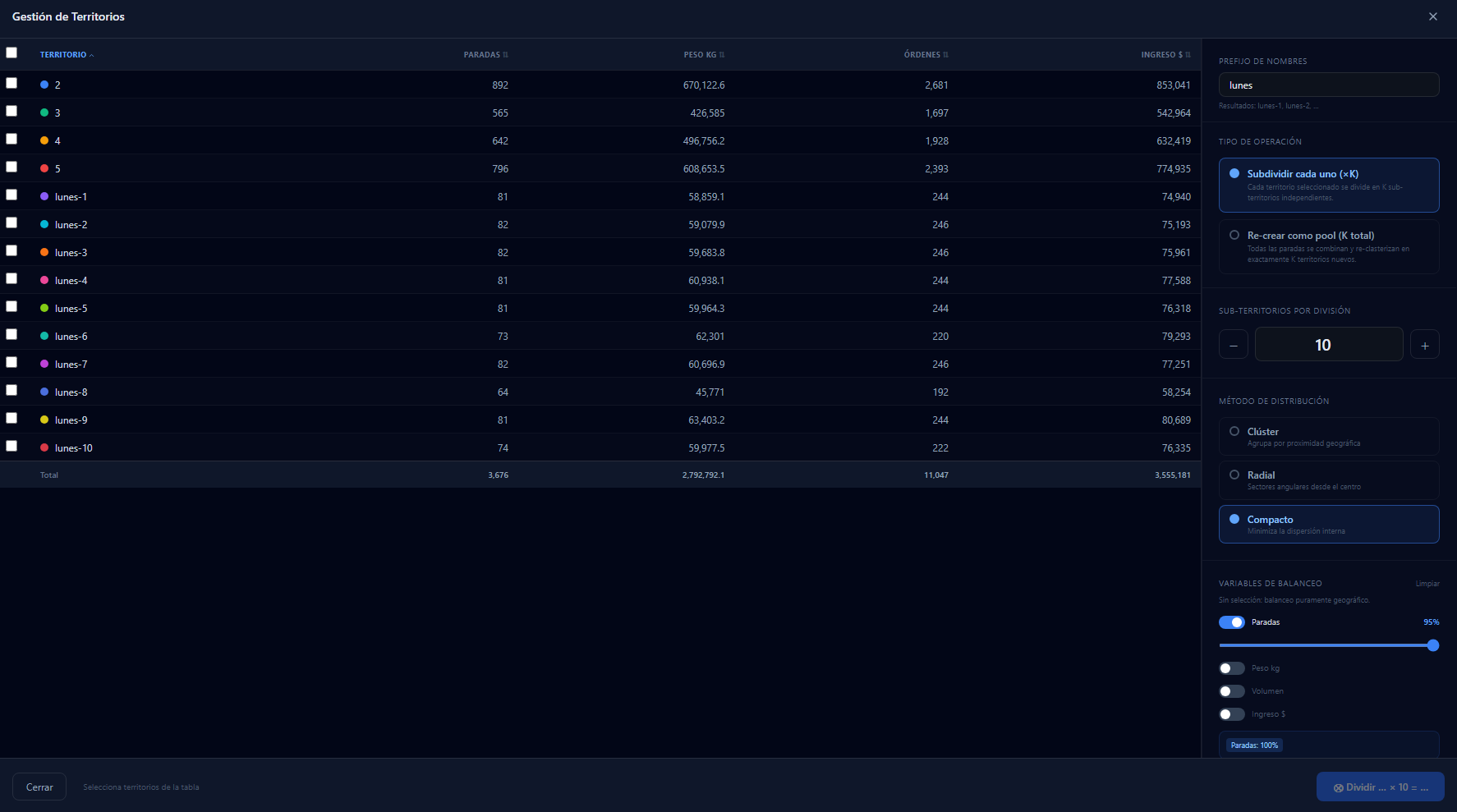
Territory management · Subdivision and balancing variables
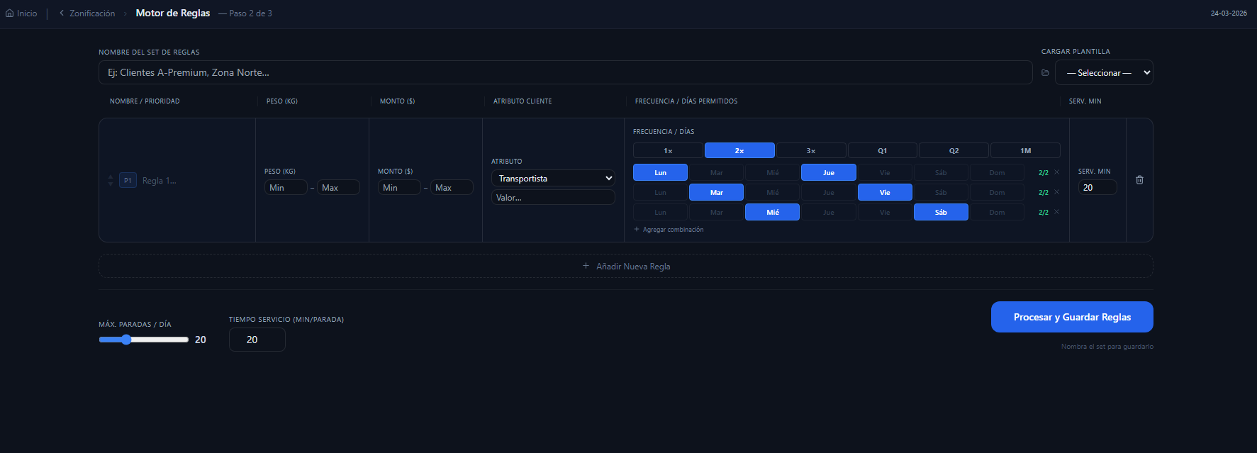
Rules engine · Frequencies and visit days
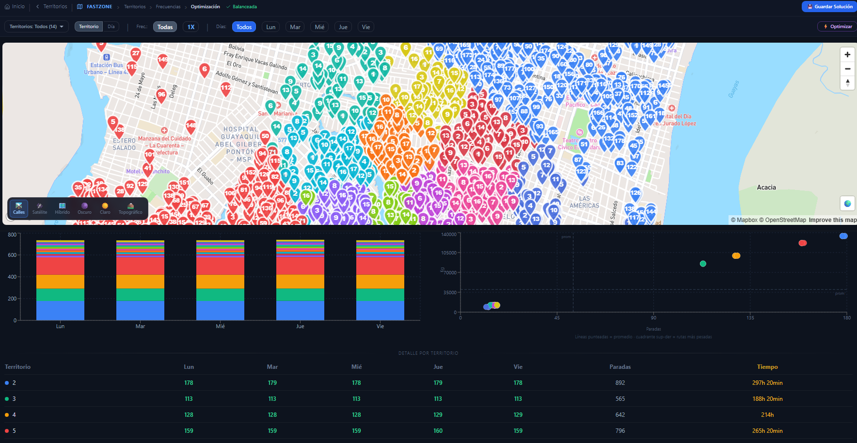
Analysis · Balance across territories and dispersion
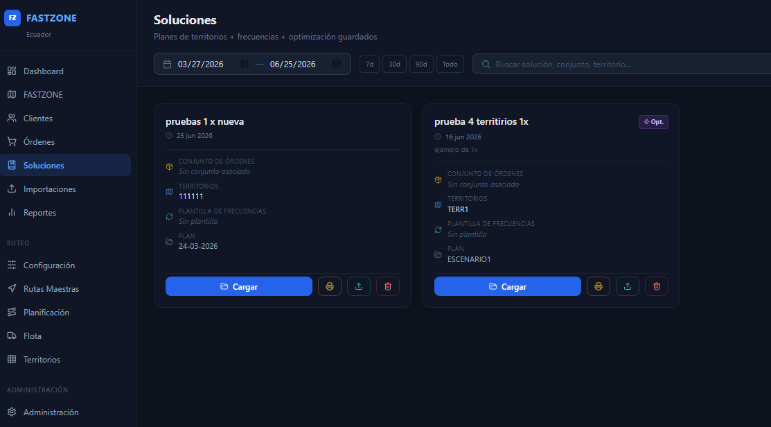
Saved solutions · Territories, frequencies and routes
Optimization · Car, motorcycle or on foot, with real time between visits
It calculates the shortest, cheapest routes in the cloud: fewer kilometers, less time and lower cost per delivery.
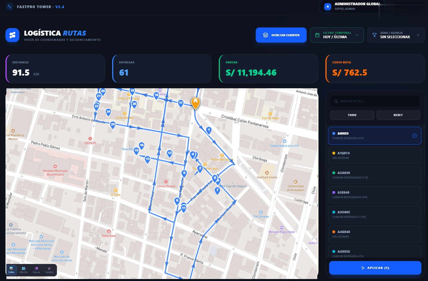
FastTrip does not just draw routes: it solves complex routing problems at scale in seconds. In a real run, the engine planned 3,760 customers across 78 routes in just 49 seconds — less than a second per route. And this is no simplified calculation: 20% of the customers had delivery time windows , on top of a maximum number of hours per route. The algorithm starts from each customer's real geographic position and calculates over the street network — real times and distances — to deliver routes that can actually be driven, not straight lines on a map.
Calculated over real streets · it honors time windows and the maximum workday
Give your planners tools to simplify complex schedules.
Build profitable, efficient routes that keep the promise made to the customer.
Keep the operation aligned from plan to execution.
Strategic route planning — Vehicle Routing Problem
Use every cubic inch of the truck and balance the weight across axles. FastBalance builds the optimal load in the cloud, honoring your product rules and the legal axle weight limits.
Optimal palletizing layer by layer · FastBalance places every package with no dead space left over.
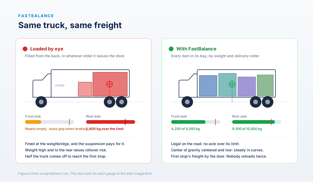
The same truck and the same goods, loaded two ways · by eye, the rear axle is 1,400 kg over the limit; with FastBalance both axles come in legal and the center of gravity sits in the middle.
It optimizes the vehicle's available space to carry more product per trip and lower the cost per delivery.
Spread the load across the axles and stay within the gross weight permitted on each.
Set loading rules by category to reduce damage and shrinkage in transit.
Web services integration to sync orders, products and load results.
Plan truck loads for several centers from a single cloud platform.
Three user levels to keep control of who plans and who executes.
Hardened connectivity for drivers, direct messaging, POD deliveries and AI analysis that does not depend on signal.
Direct driver messaging, POD and events synced the moment coverage returns.
Drivers record deliveries, POD and events with no signal. The system syncs by itself once there is coverage.
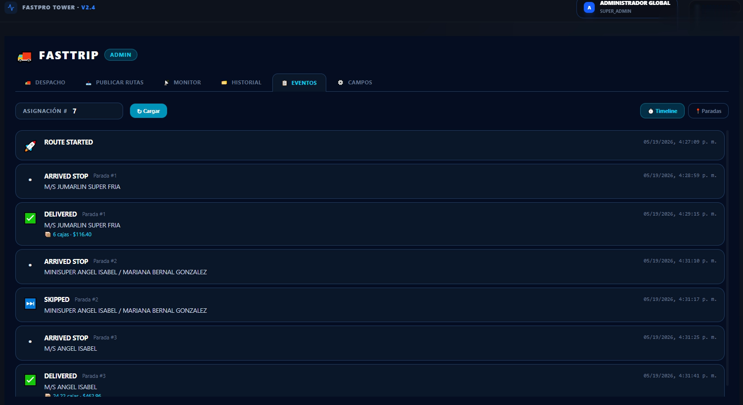
Immediate visibility of delays, deliveries and deviations, so your team decides before the problem grows.
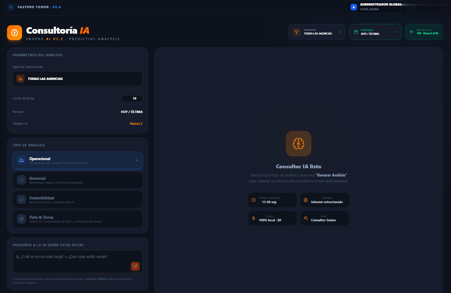
Your AI reviews historical data and offers concrete recommendations to save fuel and improve your carbon footprint.
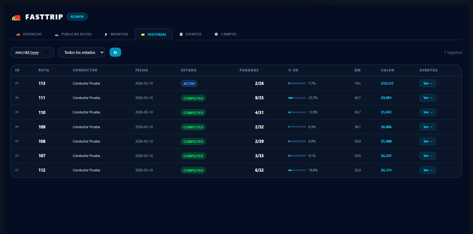
FastTrip — the offline mobile app at work: delivery tracking, geolocation and POD from the driver's phone.
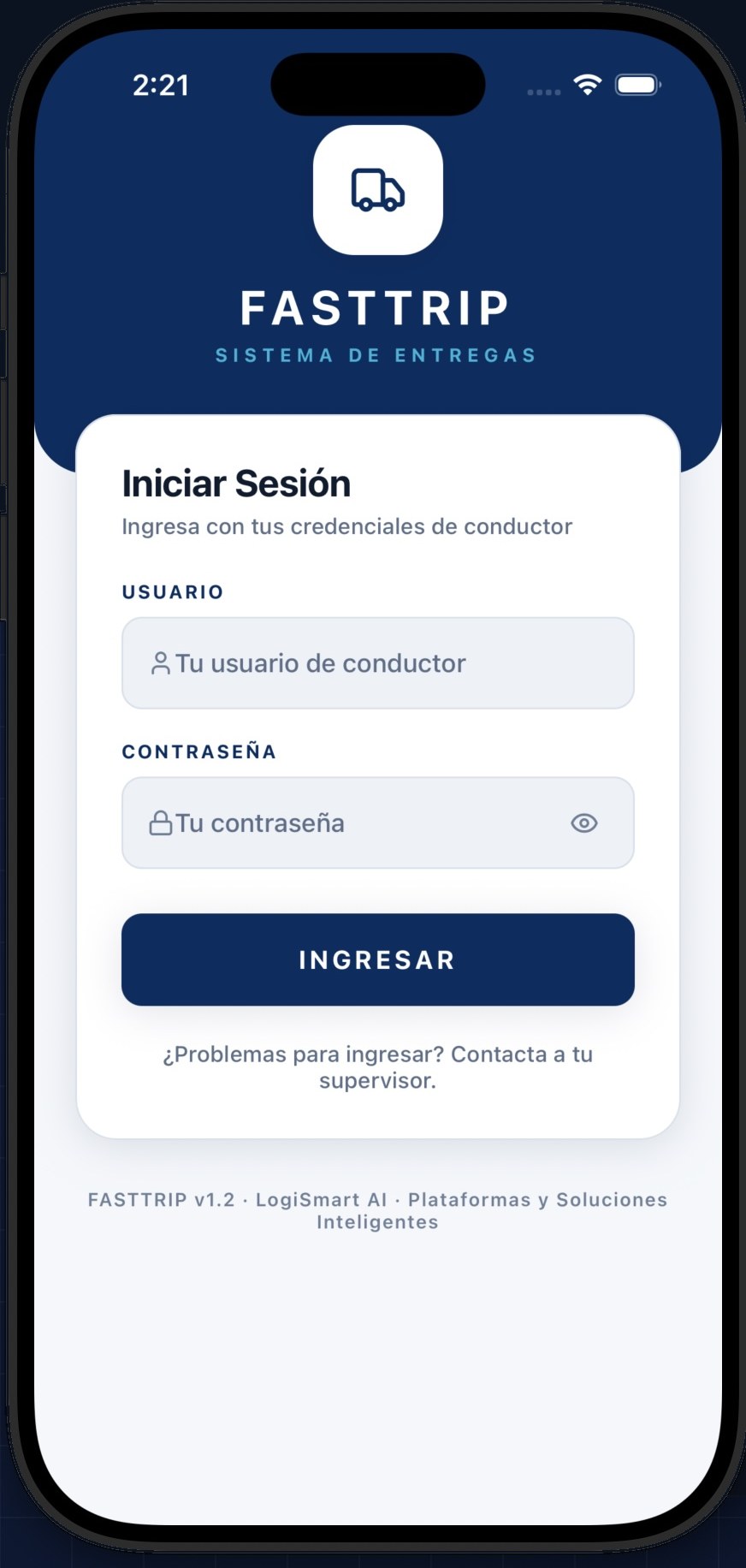
Sign-in · The driver logs in with their credentials
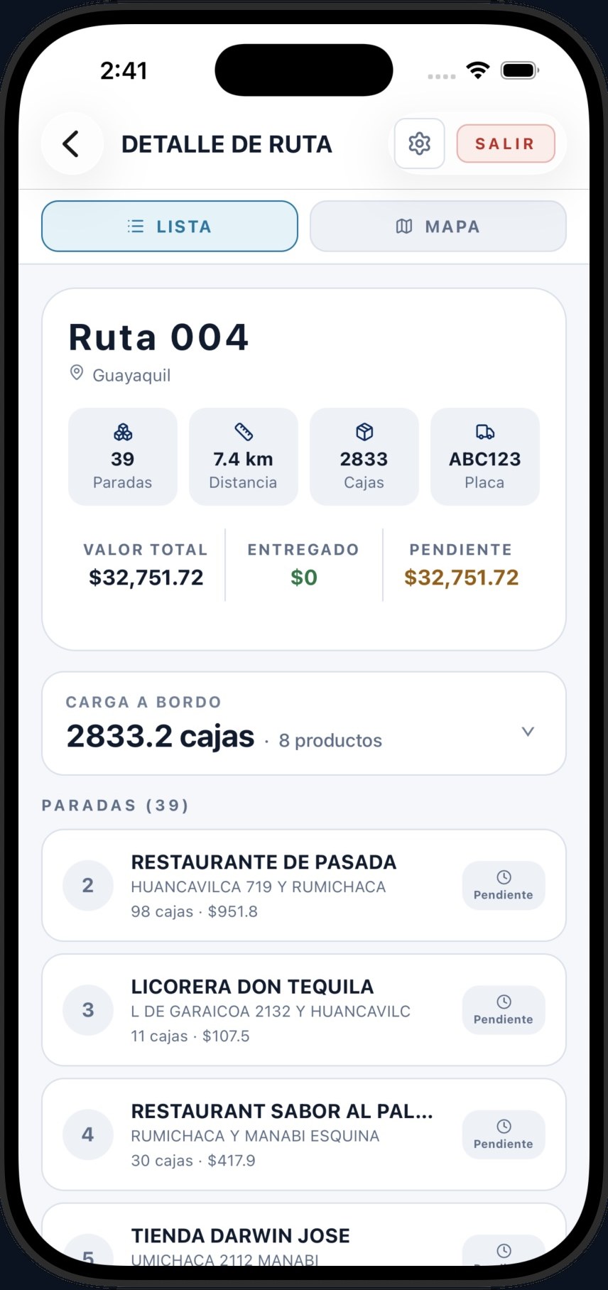
Route detail · Stops, cases, value and vehicle plate
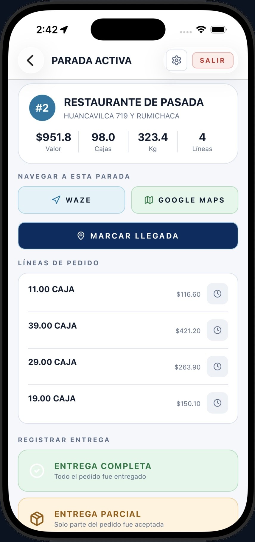
Active stop · Navigate with Waze or Google Maps and mark arrival
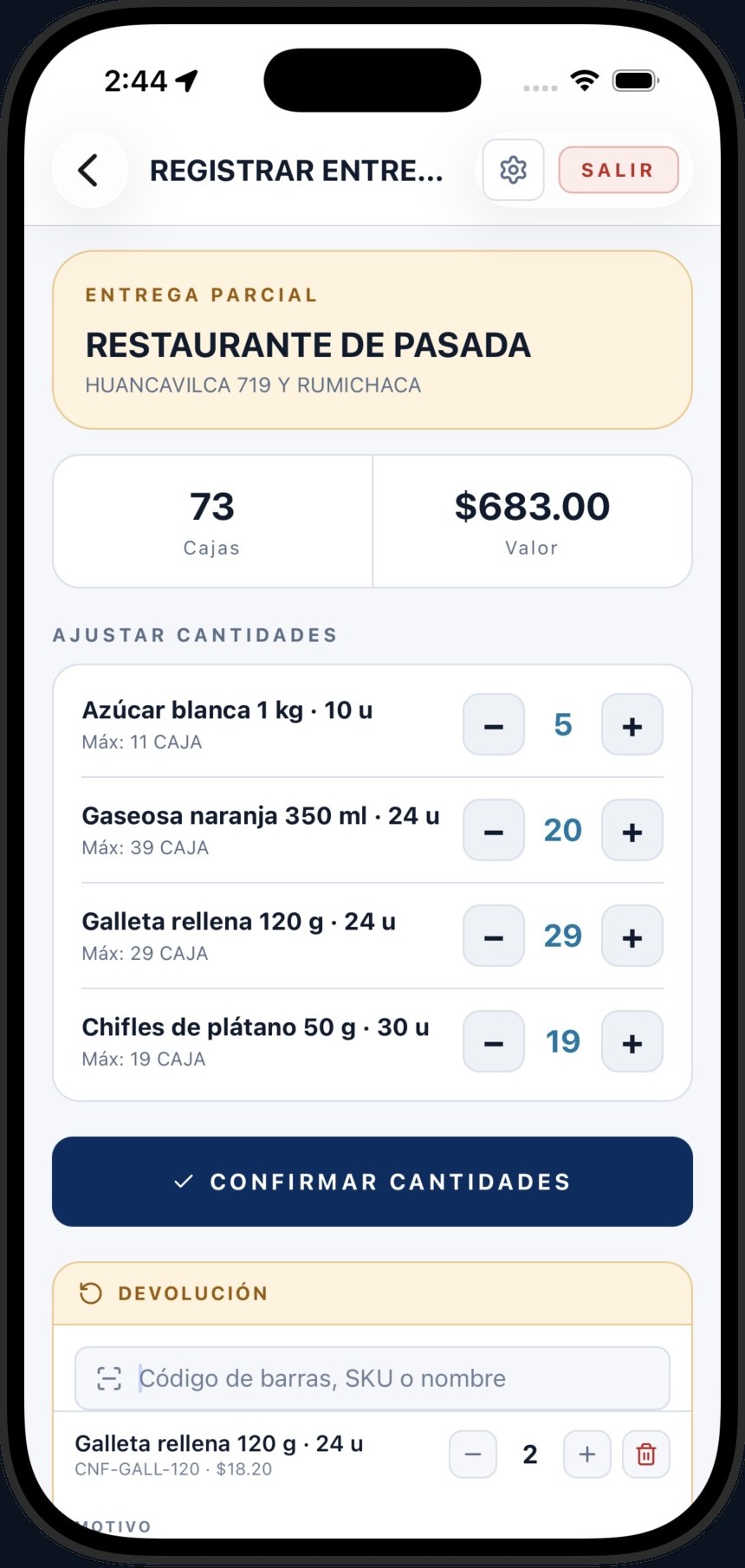
Partial delivery · Adjust quantities and record returns
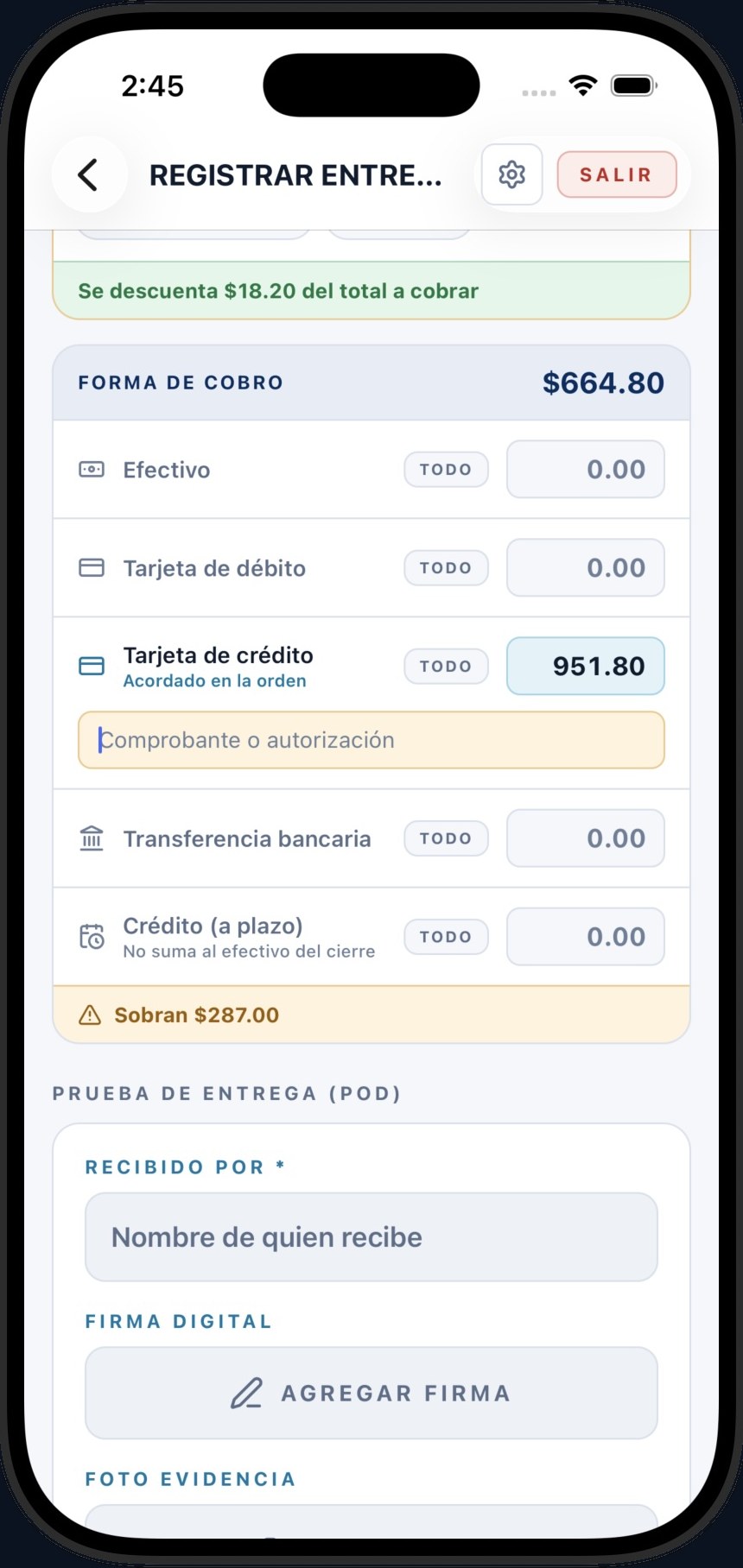
Payment and POD · Cash, card or credit terms, with signature and photo
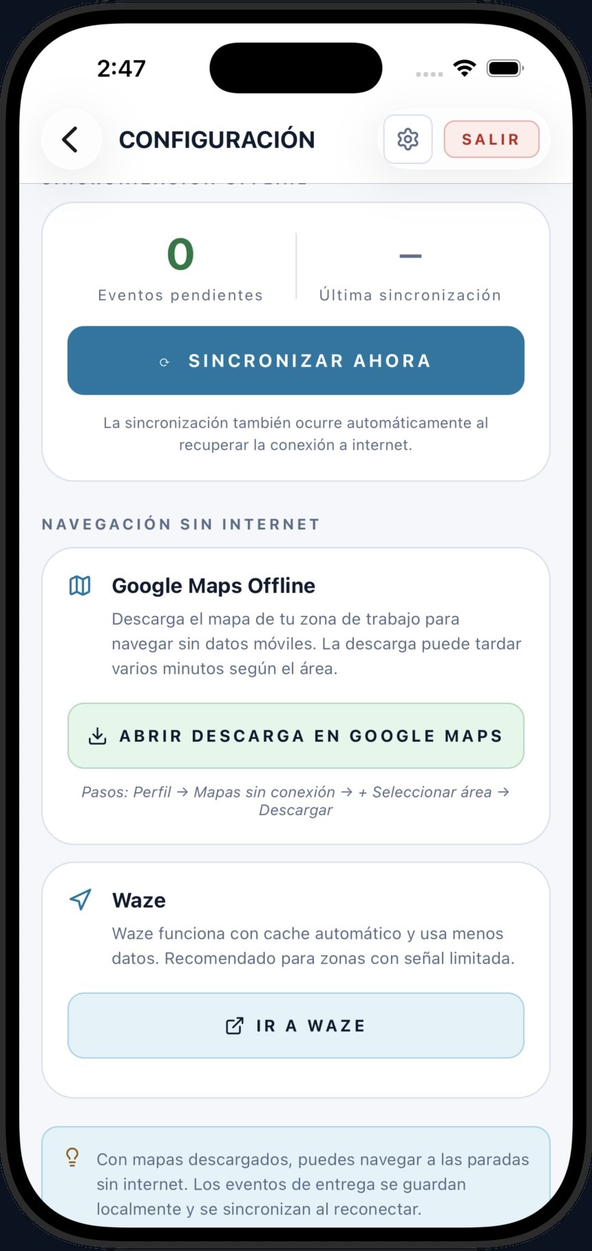
No internet · Pending sync and downloaded maps
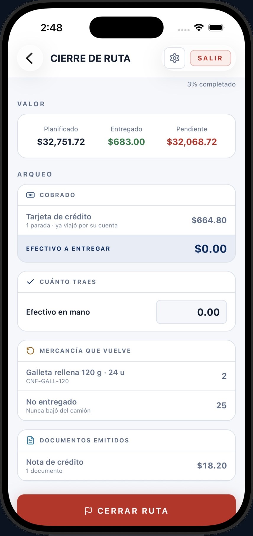
Route close-out · Cash count, returned goods and documents
A deep view of your logistics and supply chain operations, without leaning entirely on your IT team.
With our proven experience in logistics, analytics and integration, you will not depend solely on your IT team or on data scientists to get strong results quickly: you will gain a deeper view of your logistics and supply chain operations.
FastAnalytics is flexible, prepackaged and easy to use. It runs on Microsoft Power BI with standard integration, data models, dashboards and reporting templates ready to use.
The real problem is not a shortage of applications; it is the absence of integration and strategy. We do not sell loose tools: we design your territory strategy, put your data in order and implement the suite that automates your whole operation.
We design your territories and organize your data (Data Management) to clean and structure your operational information.
Sales and territories, routing and load cubing, natively integrated with your ERP (SAP and others) in record time.
Real-time monitoring with analytical dashboards and a fully offline mobile app that keeps things running in areas with no signal.
More than software: a senior team that walks with you and helps you reach your operational goals.
See your KPIs on dashboards and make strategic decisions on reliable, real-time data.
Your operation and your fleet, connected on one platform — from the plan in the tower to execution on the street.
Expert knowledge to transform your operation
Discover how data-driven territory optimization can cut costs by up to 35% while improving customer satisfaction.
Download Whitepaper →Real machine learning use cases in demand forecasting, route optimization and scenario analysis.
Download Document →Large-scale migration and a unified data architecture for a multinational logistics operation.
A major multinational company faced the challenge of managing its routing and distribution operations in isolation across 7 key countries in the region. Each country operated strictly locally, which produced:
We designed and implemented a comprehensive migration and technology centralization strategy, moving the infrastructure of all 7 countries to the company's head office in Aguascalientes, Mexico. The project rested on three pillars:
We successfully moved 240 local databases into a centralized environment, safeguarding data integrity and business continuity in every country.
We built a robust automated extract, transform and load (ETL) process that handles each operation's information, standardizes the data and consolidates reporting by country.
We built a single regional data repository that lets the company cross-reference global information and pull macro business metrics immediately after the daily route planning.
The transition was a resounding success and completely transformed the organization's analytical maturity:
The region's entire IT and data operation now runs efficiently from the head office in Aguascalientes.
The new consolidated database connects natively to feed the company's ERP systems and advanced business intelligence tools (Tableau).
The leadership team has unified dashboards to monitor the KPIs of every distribution center in the region from one place, speeding up strategic decisions.
20+ years of consulting and implementation in supply chain and transportation logistics for leading companies in the region.
Territory, route and dispatch optimization for large distributors.
Route planning and load balancing at scale.
Visit frequencies and last mile with cold chain.
Distribution with traceability and regulatory compliance.
Commercial and territory strategy in multichannel operations.
Control tower and on-route execution with in-house fleets.
A track record built on real projects. Client details are kept confidential.
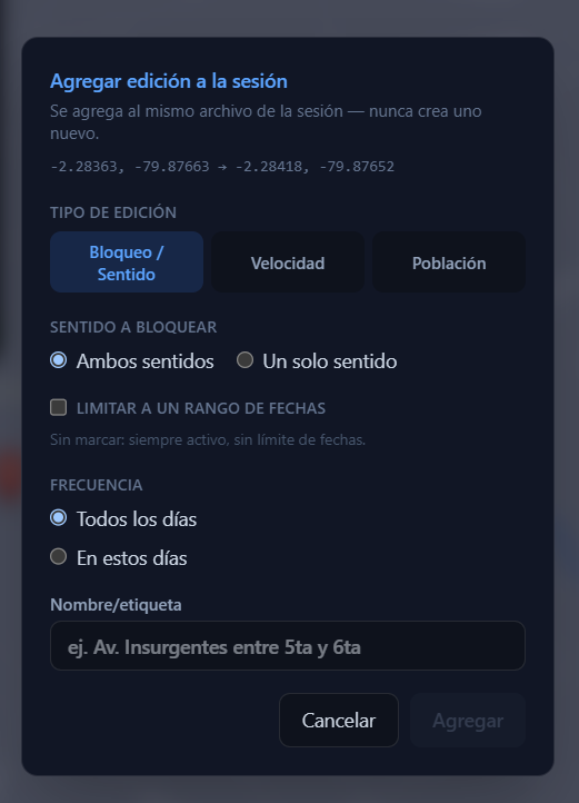
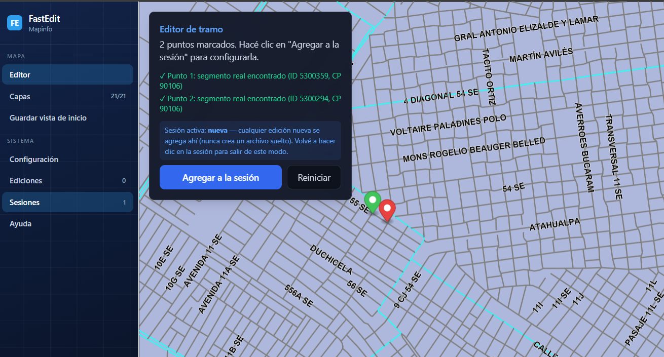
As part of our consulting, we work on your mapping in the Local Maps Base (LMB)format: editing today, with street creation and new map creation coming soon.
Edit your maps in Local Maps Base (LMB)format: mark a segment with 2 clicks and create the edit on a modern, interactive map.
Close a segment in one or both directions.
Turn a segment into a one-way street.
Adjust the segment's speed limit.
Prevent U-turns or specific turns between segments.
Change the segment's population code category.
Permanent, or by date range and specific days.
Edit type, direction to block, date range and frequency by day
Add and edit streets directly in Local Maps Base (LMB) format.
Generate new maps from scratch in Local Maps Base (LMB) format.
Built for operations and IT directors.
We support integrations with any version of SAP or any ERP on the market, through secure software layers and efficient automation — with no IT friction.
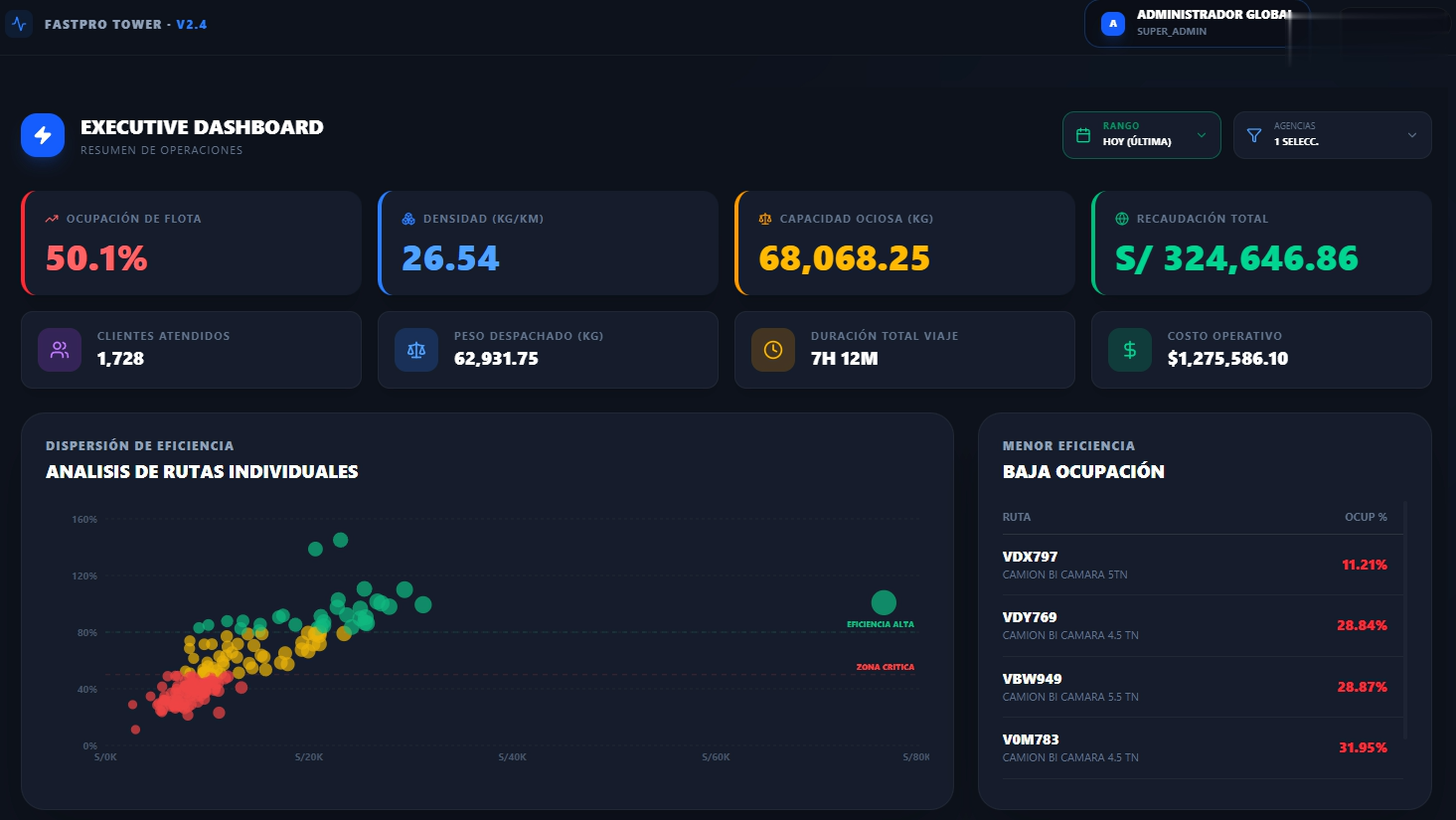
A single screen showing territory profitability, cubing efficiency and route compliance.
What people ask us most about route planning and optimization.
The main benefits are cost, efficiency and customer experience:
Yes. Our solution is built to handle large volumes of stops, routes and drivers. The software evaluates every possible route and sequence and optimizes the plans while accounting for time windows, vehicle constraints and business rules.
They are related but not the same. Planning assigns orders to routes and defines the delivery sequence; it can be done manually or semi-manually. Optimization evaluates combinations of options and constraints to produce the most efficient, profitable routes that still meet the promised windows. Our software uses optimization to build the most profitable and efficient routes automatically, cutting planning time.
Companies with complex delivery operations and large in-house fleets get the most value:
They typically see significant ROI by cutting kilometers and planning time and improving the customer experience.
It integrates with CRM, ERP, telematics, mobile and HR systems (HRIS). We have prebuilt integrations and APIs, plus a built-in mobile app for driver workflows, proof of delivery (POD) capture and execution tracking.
Yes. The solution integrates with Google Maps, Waze and Here for routing, real-time traffic and visualization.
Yes, the software takes both real-time and historical traffic data into account.
We offer a built-in mobile solution for drivers with routes, configurable workflows and POD capture. Auto-arrive and auto-depart features help measure service times accurately and improve future plans. It also integrates with your existing mobile and telematics tools.
It depends on several factors:
Tell us about your operation and we will put together a proposal that fits.
Adjust your operation's figures and see how much you could save by optimizing your routes. (sample values, edit them)
Book a meeting and find out how to carry your strategy from the cloud to the last mile with FastRoute.
Transform your operation with leading-edge technology
8365 SW 152nd Ave, Int C407
Miami, FL 33193, USA